Google Maps introduces an avalanche of innovations to improve navigation. Here they are all
The Mountain View company has decided to implement its Map service, one of the most used in the world, introducing new features that will simplify the use from home to work and beyond. Let’s see them all in this news.
Have you ever been stuck in a subway tunnel with the heat and crowding of a working day? Commuting is never simple, rather the stress for traveling from home to work and vice versa is always stressful and often difficult. For this reason, Google has decided to do something to improve, as far as possible, the life of commuters who every morning and every evening come and go from their workplace even staying in traffic for more than 60% of the time that was expected in the departure.
Google Maps will introduce new intrinsic features to this allowing users to effectively take control of their daily journey, allowing you to plan your trip in advance, prepare for sudden interruptions and thus possibly avoid them altogether.
Google Maps: know before you go
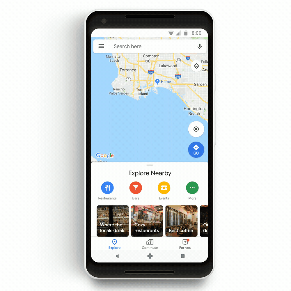
Google Maps has decided to introduce a new board for commuters that will provide access with a single tap to traffic in real time and transit information of public services in the path that is usually done by the user to go to work. In this case, the new card will allow you to view if the route is in normal traffic conditions, or if you need to leave earlier due to extra traffic caused by an accident or heavy traffic.
 In the event of delays, Google Maps will inform the user with alternative routes that will help him get to work as soon as possible. On Android smartphones, moreover, it will be possible to receive notifications about delays or interruptions during the journey so that you can know in time that an accident happened on the road.
Google Maps: support also for public transport
Very interesting is the opening of Google Maps to the means of transport that daily commuters use to get to their place of work. In this case, the new feature will be specifically inserted in Google Maps, and users will find directions not only for moving with their own car but also with public transport.
You can get information on when to leave home and especially information at any time of your trip with directions to the stops or maybe even when the next train will leave and how effectively it will take to get to the train station at the office.
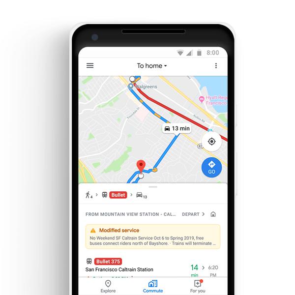 With the new feature, users will no longer have to worry and run to get to the station with the fear of having lost the train or their subway. Google Maps will allow you to monitor public transport in over 80 countries around the world, being able to visualize exactly where a specific bus is located or perhaps a train. Add to this the possibility to find out how much time you will use to reach the nearest bus stop to take that particular bus or train.
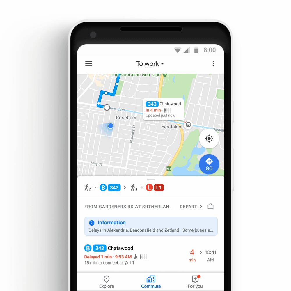 Even Google has a collaboration in Sydney with the Transport New South Wales to have in real time the ability to track and understand what is the bus crowding. This experimentation if it works will be extended to other cities in the world.
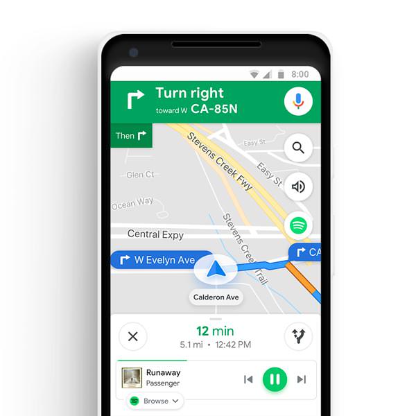
Google Maps: ” in-app ” music support
Very interesting and on the false line of Waze, the possibility to use navigation on maps while listening to music on Spotify, Apple Music and Google Play Music also arrives on Google Maps. This case, thanks to the integration of a special menu underneath the indications and the map, it will be possible to have the control of the favorite tracks even while receiving indications on the traffic or on the road to go.